

Key Takeaways
- Volcanic lakes merge beauty with a tempestuous past.
- They hold secrets of our planet's fiery interior.
- We explore their origins using verifiable scientific insights.
Volcanic lakes are nature's potent paradox—serene yet formed by fury.
Ever wondered what lurks beneath those tranquil waters resting in the mouths of volcanoes?
These hauntingly beautiful lakes conceal explosive histories, creating unique ecosystems where fire once reigned.
You're embarking on a journey through time and geology.
Revealing the tales of volcanic lakes, we unveil nature's artistry, sculpted by the raw power of Earth's inner heat.
Ensuring authenticity, we draw from geological events and firsthand observations to provide you with a trustworthy narrative.
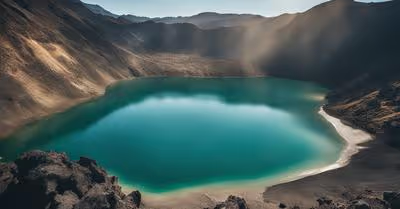
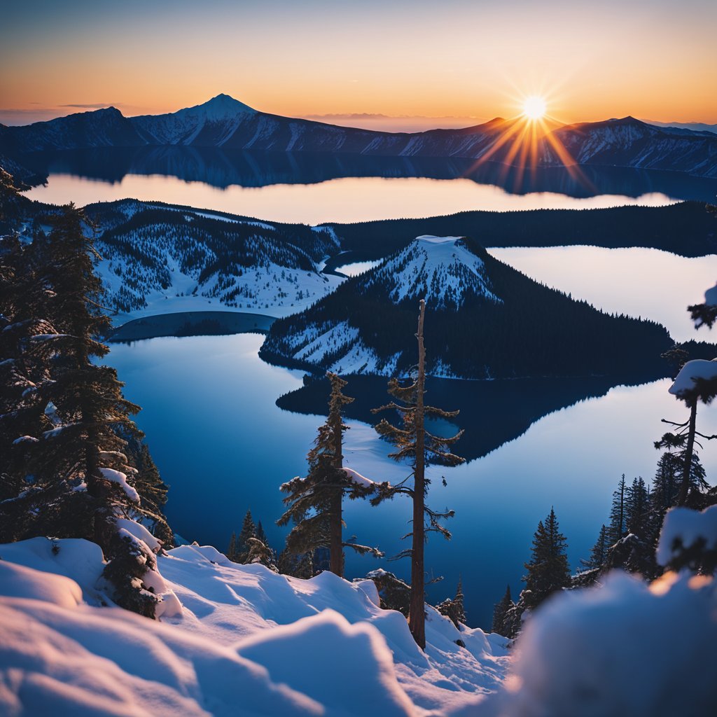
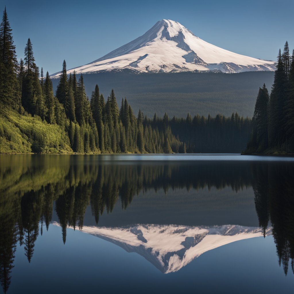
Crater Lake (Oregon)
Have you ever gazed into a lake so blue it seemed like a piece of the sky fell into it?
That's the magic of Crater Lake in Oregon! 7,700 years ago, Mount Mazama said 'goodbye' to its peak in a spectacular fashion, leading to the creation of this stunning lake.
Crater Lake isn't just any lake; it's the deepest in the United States, going down a whopping 1,949 feet.
That's like stacking five Eiffel Towers, one on top of the other!
And it's not just deep—it's also exceptionally clear, thanks to being fed by nothing but rain and snow.
No rivers run in or out, keeping it pristine.
Thinking of taking a dip?
Hope you don't mind the chill!
The water stays around a brisk 55°F (13°C), so it's quite the refreshing experience.
But remember, the lake's shores are a bit on the exclusive side, giving you limited spots to dive in.
You'll want to stick to designated swimming areas and play it safe.
Here's the lowdown for potential visitors:
- Best Visit Time: The mild weather from July to mid-September makes it prime time for enjoyment.
- Hiking Options: Lace up for trails ranging from a casual half-mile stroll to a more adventurous five-mile trek.
So there you have it—Crater Lake in a nutshell.
It's a place where nature's drama has crafted one of the planet's purest and most mesmerizing wonders.
Don't you think it's time for you to witness its awe-inspiring beauty?
Newberry Caldera (Oregon)
Have you ever stood atop a volcano and gazed upon twin lakes nestled in its heart?
If not, let me guide you through the wonders of Oregon's Newberry Caldera.
Picture this: a massive volcano that's been a hive of activity for over 400,000 years.
Yes, you heard that right!
Newberry Caldera is the spectacular result of Earth's fiery power.
With a history of eruptions dating back hundreds of thousands of years, it has since transformed into a serene setting.
Central to this transformation are Paulina Lake and East Lake, two of the caldera's eye-catching features.
These volcanic lakes lie side by side, each fed by an intricate combination of snowmelt, rainfall, and mysterious hot springs bubbling up from the depths.
Quick Facts:
- Paulina Lake Elevation: 6,331 feet
- East Lake Elevation: Slightly higher than Paulina
- Newberry Caldera Size: Approximately 4 by 5 miles
- Age of Caldera Formation: Around 75,000 years old
- Notable Features: Central Pumice Cone at 7,084 feet
The caldera you see today showcases a brilliant tapestry of geological features with its 54,000+ acres of diverse landscapes.
Imagine standing atop Paulina Peak, the highest point in the area at 7,985 feet, where breathtaking views span across the caldera, the snow-capped Cascades, and the expansive High Desert.
So, whether you're a lover of geology, a fan of hiking, or just in search of peace by a lakeside, Newberry Caldera has a spectacle waiting for you.
Remember to bring your camera, your sense of adventure, and a willingness to be awed by nature's resilience and beauty.
Ready to explore?
Medicine Lake (California)
Ever wondered what happens when Mother Nature decides to play architect with volcanic materials?
Let me take you on a tour of Medicine Lake, nestled in northeastern California.
It's not your typical lake—this one has a fiery past that's just as vibrant as its serene present.
Medicine Lake is the crowning glory of the Medicine Lake Volcano.
Imagine this: over the course of 500,000 years, volcanic eruptions have sculpted the landscape, giving rise to the lake we see today.
Quite the long-term project, eh?
The most recent eruptions sprinkled their magic about a millennium ago, leaving behind this tranquil basin.
Here's the scoop on the size: Medicine Lake spans a massive area nestled within a shield volcano.
The volcanic region itself commands an area of about 850 square miles.
That's a colossal natural canvas shaped by Mother Earth’s volcanic whims!
The lake sits at the summit, in a caldera basin that's 7x12 kilometers.
It’s like nature’s own version of a hot tub, only much, much bigger and cooler.
The volcano is part of a larger volcanic area that lies east-west and has features dramatically different from what you'd expect from the Cascades.
While other volcanoes boast sharp peaks, Medicine Lake's volcano is more of a gentle giant with its broad shield shape.
- Location: Northeastern California
- Formed: Over 500,000 years of volcanic activity
- Most Recent Eruptions: Approximately 1,000 years ago
- Type of Volcano: Shield volcano
So, take a moment to marvel at this natural wonder.
You're looking at half a million years of Earth's history, etched into a landscape that offers both beauty and a testament to our planet's dynamic character.
Next time you're pondering a trip, why not stand at the edge of that vast caldera and soak in the view that nature has been designing for eons?
Mount St. Helens' Spirit Lake (Washington)
Have you ever heard of a lake that bears the scars of a volcanic eruption like a badge of honor?
Well, let's chat about Spirit Lake at Mount St.
Helens, and trust me, it has quite the story to tell.
Imagine a serene lake, a go-to spot for campers and nature lovers, surrounded by six camps including the Boy and Girl Scouts.
Then, in 1980, boom—the picturesque scene changed overnight.
When Mount St.
Helens erupted on May 18, 1980, it wasn't just an ordinary day for Spirit Lake.
The eruption caused a colossal landslide and sent debris hurtling into the lake, changing its structure and ecosystem completely.
But guess what?
The lake, resilient as ever, adapted and transformed.
- Pre-Eruption Attractions: Six camps, including Boy Scout Camp and the Girl Scout Camp
- Eruption Impact: On May 18, 1980, massive landslides reshaped the lake
- Post-Eruption: Harry R. Truman, who owned a lodge by the lake, famously refused to leave
Now, you might be thinking, "Is the lake still interesting to see?" You bet!
The 52-mile Spirit Lake Memorial Highway gives you a front-row seat to this area's history and ongoing natural rebirth.
You'll journey right into a volcanic blast zone, a rare treat in the United States.
Did you know the logs from the trees knocked down during the eruption still float on the lake after four decades?
These silvery logs are a testament to nature's raw power and tenacity.
So, while Spirit Lake isn't the tourist haven it once was, it's become an extraordinary natural classroom where you can witness the aftermath of volcanic fury and the resilience of Mother Nature.
Isn't that something worth adding to your road trip list?
Lassen Volcanic National Park's Boiling Springs Lake (California)
Ever dreamt of seeing a lake that's literally boiling?
Well, think no more, because Boiling Springs Lake at Lassen Volcanic National Park is one such natural wonder.
It's like the park's natural hot pot – except you definitely can't take a dip!
Quick Facts:
- Trail Distance: 2.4 miles round trip
- Elevation Change: Roughly 300 feet
- Lake Temperature: Stays around 125 degrees Fahrenheit
- Notable Features: Steam vents, mudpots
- Location: Warner Valley area
Imagine you're walking on an easy trail shaded by forest canopy, the path sprinkling just a bit of adventure with a 200-foot climb.
In a couple of hours, you’ll reach this impressive geothermal marvel.
Boiling Springs Lake is set in the scenic splendor of Warner Valley, a tiny piece of nirvana where steam vents work overtime beneath the lake, keeping its temperature steamy hot – yes, to the tune of 125°F!
This body of water is no ordinary lake; it's the largest active feature in Lassen Volcanic National Park and, compositionally speaking, pretty acidic due to the volcanic activity nearby.
Remember Lassen Peak's spectacle of 1915?
It’s that very volcano that powers the lake's thermostat today.
What to Look Out For:
- The mudpots on the southeast shore. They are like nature’s own clay spa treatments, except they're just for show!
- Those little steam vents that make you feel like you're on another planet.
The hike itself is generously rewarding, and it's unlikely you'll have to elbow your way through crowds.
Plus, if you're a fan of tall tales and wide open spaces, fellow hikers might share stories spanning from Mexico to Canada!
Now, are you ready to check out Boiling Springs Lake?
Lace up those boots, pack a snack, and don't forget to bring your sense of wonder!
Yellowstone National Park's Yellowstone Lake (Wyoming)

Did you know that nestled in the rugged wilderness of Wyoming lies a truly magnificent sight?
Yep, I'm talking about Yellowstone Lake in Yellowstone National Park – it's not just your ordinary lake, but a watery wonder with a fiery secret beneath!
So, what makes Yellowstone Lake stand out?
First off, it’s huge!
This lake stretches about 20 miles long and 14 miles wide, making it the largest high-elevation lake in North America above 7,000 feet.
Imagine that vast expanse of water, a jewel among mountains, teeming with cutthroat trout and framed by forests.
And it gets even more impressive when you realize the entire lake is over a volcanic hotspot.
That's right, the tranquil water sits atop the Yellowstone Caldera – a sleeping giant of a volcano with a history of making some serious noise.
- Last Major Eruption: Approximately 640,000 years ago
- Elevation: 7,733 feet (2,357 m) above sea level
- Shoreline: 141 miles (227 km)
- Surface Area: 132 square miles (342 km²)
- Average Temperature: Around 40 degrees Fahrenheit
Each winter, Yellowstone Lake becomes a frosty wonderland as it freezes completely over, not thawing until June rolls around.
Fancy ice fishing or snowshoeing across a frozen lake with a supervolcano beneath your feet?
Only here, folks!
Remember to bring your camera because the combination of crisp blue waters against the backdrop of the park's famous geysers and wildlife is a photographer’s dream.
Just picture the steam from nearby hydrothermal features dancing across the lake's surface on a cold morning – it's pure magic!
Mount Mazama's Wizard Island (Oregon)
Have you ever wondered about the magic behind Wizard Island?
No, it's not a place with wizards and spells, but it's still quite enchanting!
Nestled in the heart of Crater Lake, Wizard Island is not your typical isle.
It's actually a cinder cone, a type of volcanic mountain, and is one of several that grew after Mount Mazama's climactic eruption roughly 7,700 years ago.
Think of it as a natural time capsule from a volcanic tantrum.
While the rest of Mount Mazama crumbled, this cinder cone stood tall—well, as tall as a cinder cone can!
Wizard Island reaches an elevation of 6,933 feet, with 755 feet peeking above the current lake level, proudly displaying its volcanic crater about 500 feet wide and 100 feet deep at the summit.
Wizard Island Stats:
Elevation above sea level: 6,933 feet
Height above lake level: 755 feet
Crater dimensions: 500 feet wide, 100 feet deep
Can you imagine the sheer force it took to create this spectacle?
The last eruptions that formed Wizard Island took place when Crater Lake was about 260 feet lower.
Only 2% of the island is visible today, which gives you a sense of just how massive the lake—and the volcanic activity—must have been.
So next time you're gazing out across the deep blue of Crater Lake, remember the fiery history hidden in plain sight.
It's not just a lake; it's a testament to the earth's incredible power and a hint of the fiery dance that went on here thousands of years ago! 🌋🏝️
Mount Katmai's Novarupta Dome (Alaska)
Hey there, have you ever heard about the mind-boggling eruption of Novarupta Dome in 1912?
It's not exactly your everyday volcanic event—it was the largest one in the 20th century!
Imagine the scene: an entire landscape around Mount Katmai forever altered by a cataclysmic blast.
Let's set the stage—June 6, 1912: a massive Plinian eruption kicks off, and boy, does it reshape the Earth.
You've got an ash cloud shooting up an unbelievable 20 miles into the sky.
The folks in Kodiak, a hundred miles away, experienced ashfall just a few hours after the eruption began.
Can you picture the sky going dark in the middle of the day?
And then, there's this jaw-dropping number: 3.1 cubic miles (13 km³) of magma burst forth.
Just for a sense of scale, that's a chunk of material large enough to fill up an Olympic-sized swimming pool over a million times!
Now picture this: amidst the chaos, the Novarupta lava dome forms, and get this—it's part of the larger Katmai volcanic complex, where lakes today cradle in the arms of volcanic landforms.
You’re probably wondering about the Valley of Ten Thousand Smokes—well, that's the aftermath, the expanse where the eruption left rivers of hot ash flows that solidified into a barren, yet compelling, landscape.
Remember, while Novarupta isn't famous for creating a lake, the nearby volcanic transformations did culminate in water-filled basins, beautifying a once devastated area.
So, next time you're browsing through geological marvels, tip your hat to Novarupta and its dramatic reshaping of Alaska's wild terrain.
Mount Hood's Trillium Lake (Oregon)
Ever yearned for a postcard-perfect spot that's easy on the legs but big on rewards?
Well, have you heard about Trillium Lake nestled under the watchful presence of Oregon's own Mount Hood?
Mount Hood, by the way, isn't just any regular peak—it's an active volcano with a past dotted with dramatic eruptions!
Don't worry, it's been quiet for a while, so let's talk lake, not lava.
Imagine a 1.9-mile loop hugging the edges of Trillium Lake; its tranquility echoes the serene mood you're after.
It's easy peasy too, meaning anyone can visit, from your little niece to Grandpa Joe!
With merely 10 feet in elevation gain, it’s more of a leisurely stroll than a hike, and it’s packed with nature’s finest.
While Trillium Lake isn't a fiery volcanic crater, it's special because of its up-close encounter with Mount Hood's slopes.
Reflect upon its glassy surface; if you're lucky, the mountain's reflection is so crisp and clear, it’s as if Mother Nature painted it just for you—no filter needed!
Here's a neat list of what to expect:
- Distance: 1.9 miles round trip
- Elevation Gain: 10 feet – yes, that's not a typo!
- Difficulty: Easy – kick back and relax!
- Activities: Fancy a swim? How about fishing or canoeing?
Remember the movie The Shining?
The historical Timberline Lodge nearby is where parts of it were filmed.
Add some thrill to your chill; it's only a stone’s throw away!
So, when are you going to take that selfie with Mount Hood at the backdrop by Trillium Lake?
Pack some snacks and make those hiking boots work a tiny bit – the lake's bliss is calling your name!
Mount Rainier's Reflection Lakes (Washington)
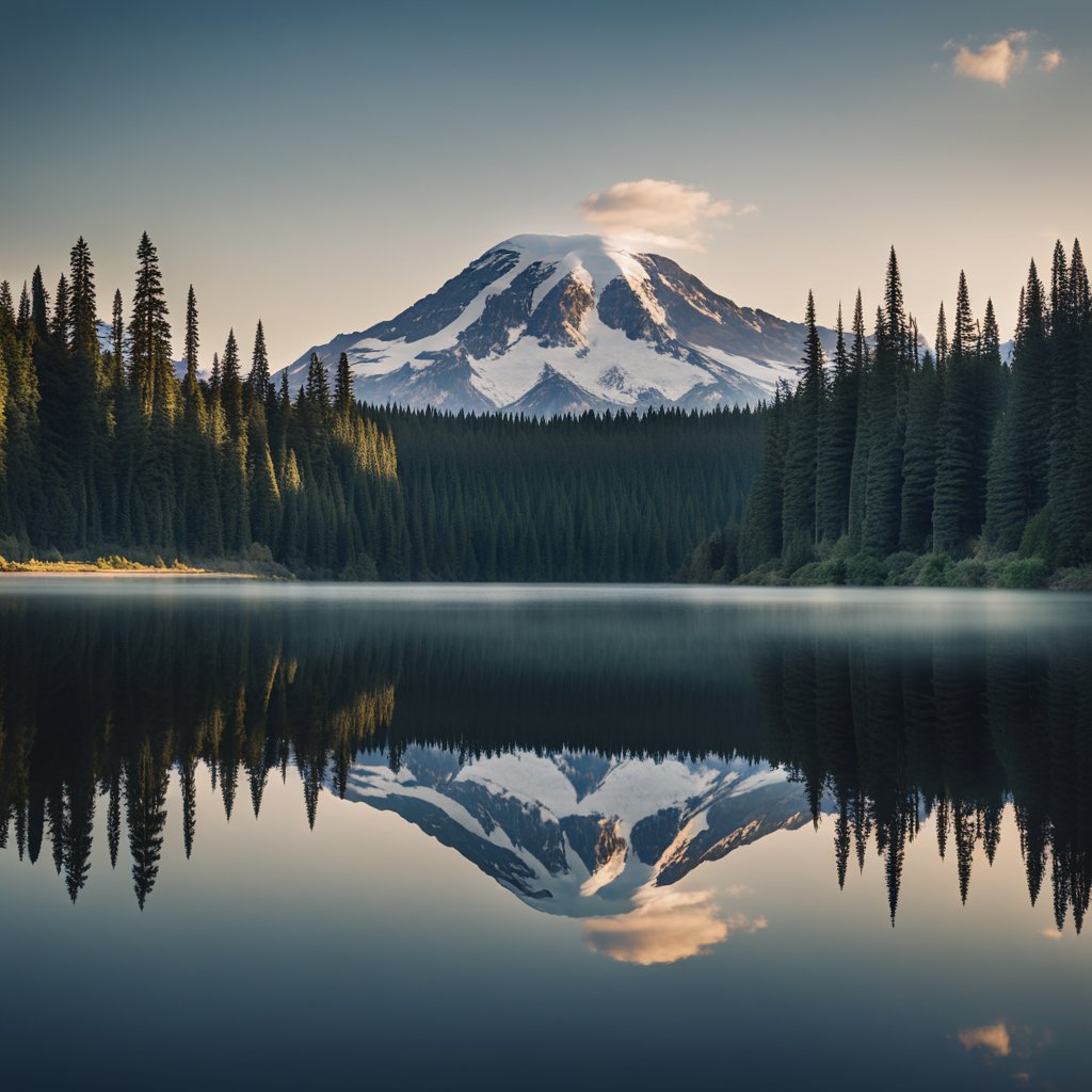
Have you ever seen something so breathtaking that it looks like it's straight out of a fairy tale?
Well, tuck that feeling away, because you'll need it when you visit Mount Rainier's Reflection Lakes.
These stunning lakes, nestled in the embrace of an active stratovolcano, offer a visual feast that manages to be both tranquil and exhilarating.
So, what's so special about visiting these lakes?
Let me walk you through.
First off, you're gazing at reflections of Mount Rainier, which towers majestically at over 14,000 feet.
That's right, we're talking about an active volcano, with a past dotted by eruptions and lahars that have sculpted the land around it.
Isn't it mind-blowing to be so close to such a giant?
Now for the adventurer in you: The trails around the lakes are a hiker's paradise.
- Starting Point Coordinates: 46.769167, -121.723889
- Trailhead Coordinates: N 46° 46′ 06", W 121° 43′ 45"
- Faraway Rock Coordinates: N 46° 46′ 27", W 121° 43′ 08"
You're looking at a moderately challenging 6.5-mile loop trail that takes 3 hours and 44 minutes on average to complete.
Remember, the best times to visit are from June through September—just the right window to plan your trip!
The Reflection Lakes area is not just about the trails though; it's a hotspot for runners and fellow hikers like yourself, meaning you can share stories or even make new friends along the way.
And if you find yourself there, can you imagine the photos?
You'll capture the mountain in ways you never thought possible, especially on a calm morning when the mirror-like water is undisturbed.
Just take a moment there, will you?
Sit by the lakeside, the cool breeze kissing your face, and let nature's grandeur do what it does best—leave you in awe.
It's not just a visit; it's an experience that whispers of volcanic power and beauty all in one breath.
What more could you ask for?